
Here is the train of thoughts that lead to this Google Maps Discovery.
- Read news story about oil leak that has contaminated drinking water near Pearl Harbor.
- Go to Google Maps to see what Pear Harbor actually looks like.
- Browse Google Maps in street view to see what an an average street on a Haitian Island looks like.
- Aimlessly float over the islands until I reach Midway Islands.
- On a whim decide to drop street view pin on former military base and am shocked to see there actually is a street view!
That’s right, you too can now visit the famous Midway Islands. I was very surprised to see a very extensive trail of street view photos on this island covering nearly every major section of the former Navy base. While much of the larger infrastructure is various states of decay there is still an active US Fish and Wildlife presence on the island. There appears to be an active runway with two crash trucks, a power plant, maintenance shops, and millions of birds. You can even see the Officer-In-Charge house that President Nixon used to secretly meet South Vietnamese President Nguyen Van Thieu in 1969.
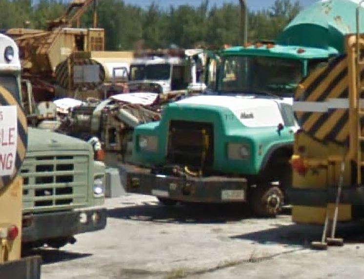
But I digress. If you visit the islands browse just east of the sea plane hanger near the large man made harbor. From above it will look like nothing but broken concrete but dropping to street view you can view the island boneyard collection.
 Look at this neat old R-Series International fire truck. And what about this Mack mixer truck. Looking closely in the background there appears to be a Peterbilt with hood removed. Possible narrow nose?
 Plenty of heavy equipment and square bodies too!
 Neat!
Neat!
